
The Colorado River is considered one of the great rivers of North America. Although other rivers are longer or carry more water, few rivers can compare with the wonder of the Colorado River as it winds through the landscape, cascading down mountains, carving colossal canyons, and nourishing habitats in arid and thus biologically strained environments. The natural landscape of the regions influenced by the River, such as the Colorado Mountains, the Grand Canyon, and Delta region, are legendary, however the fame of the Colorado River lies in the often complex and critical role it plays in today’s society. In the climate of the Southwestern United States and Northwestern Mexico, the waters of the Colorado River are as valuable as gold. Cities have grown to depend on it for human consumption; some of the most productive agricultural lands in the United States require it for irrigation; houses depend on the hydroelectric power generated by it. Meanwhile native species depend on the ecosystems nourished by it.
All of these demands combine to make one of the most interesting studies in multi-objective planning and management. With such a critically scarce supply and high demand, essentially every drop of the Colorado River is accounted for and diverted from the River, often leaving the channel dry as it enters the ocean.
In this unit we will discuss:
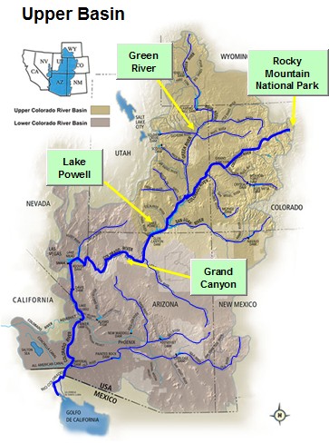
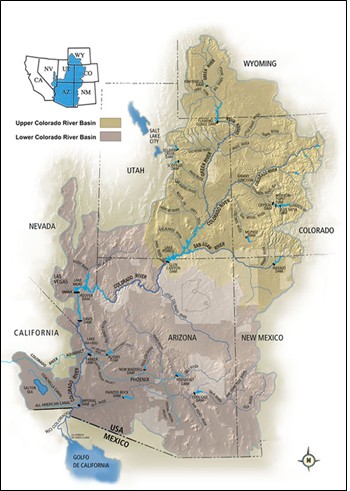
The Colorado River collects water that falls over a 245,000 square mile (635,000 km2) area, covering a region known as the Colorado River Basin. The source of the Colorado River is typically considered to be in the high mountains of Colorado in Rocky Mountain National Park at elevations near 14,000 ft (4200 m) above mean sea level. Although the vast majority of the water does come from the high mountains of Colorado and Wyoming, the channel of the Colorado River is fed by rain and snow that falls throughout the basin.
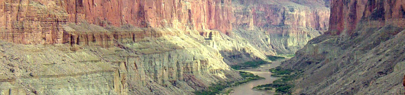
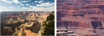
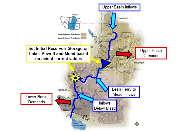
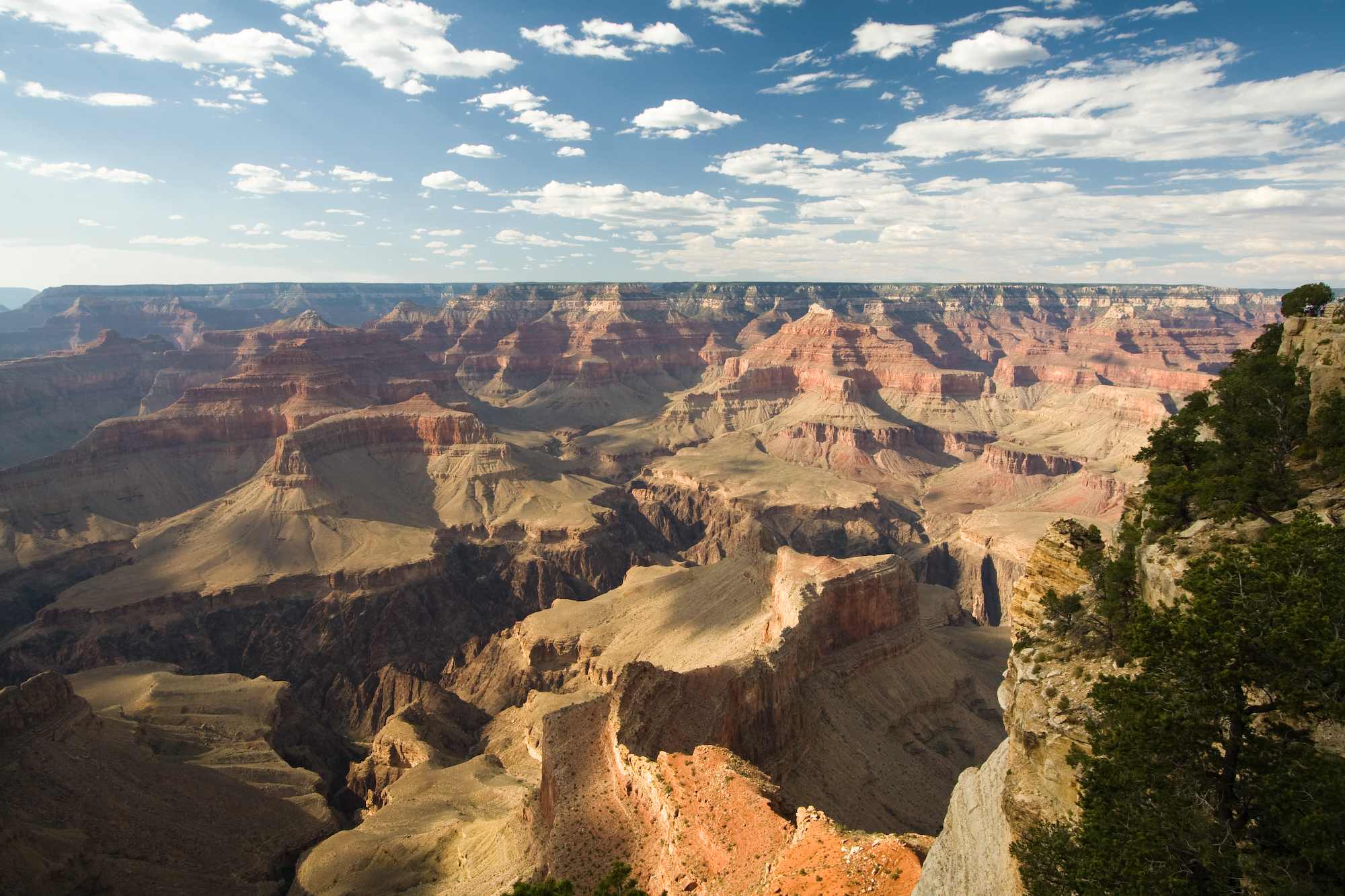
The River descends from the western side of the Rocky Mountains and winds its way through the red sandstone canyons of Utah. After joining with waters from the Green River flowing from Wyoming, the Colorado River flows into Lake Powell. This major reservoir provides numerous recreational opportunities in addition to water storage for downstream uses. After passing the Glen Canyon Dam which forms Lake Powell, the River winds through the world famous Grand Canyon in Arizona, which provides a stunning view and understanding of the ancient role the River has played in sculpting the land surface.
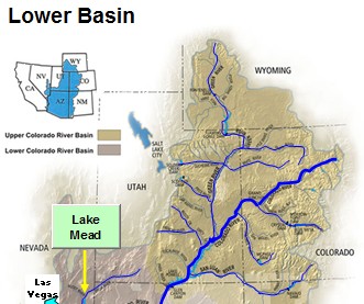
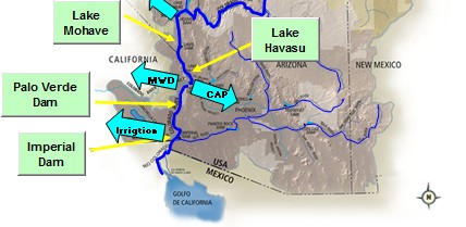
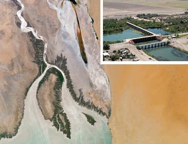
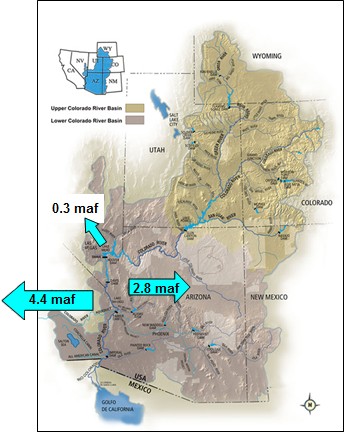
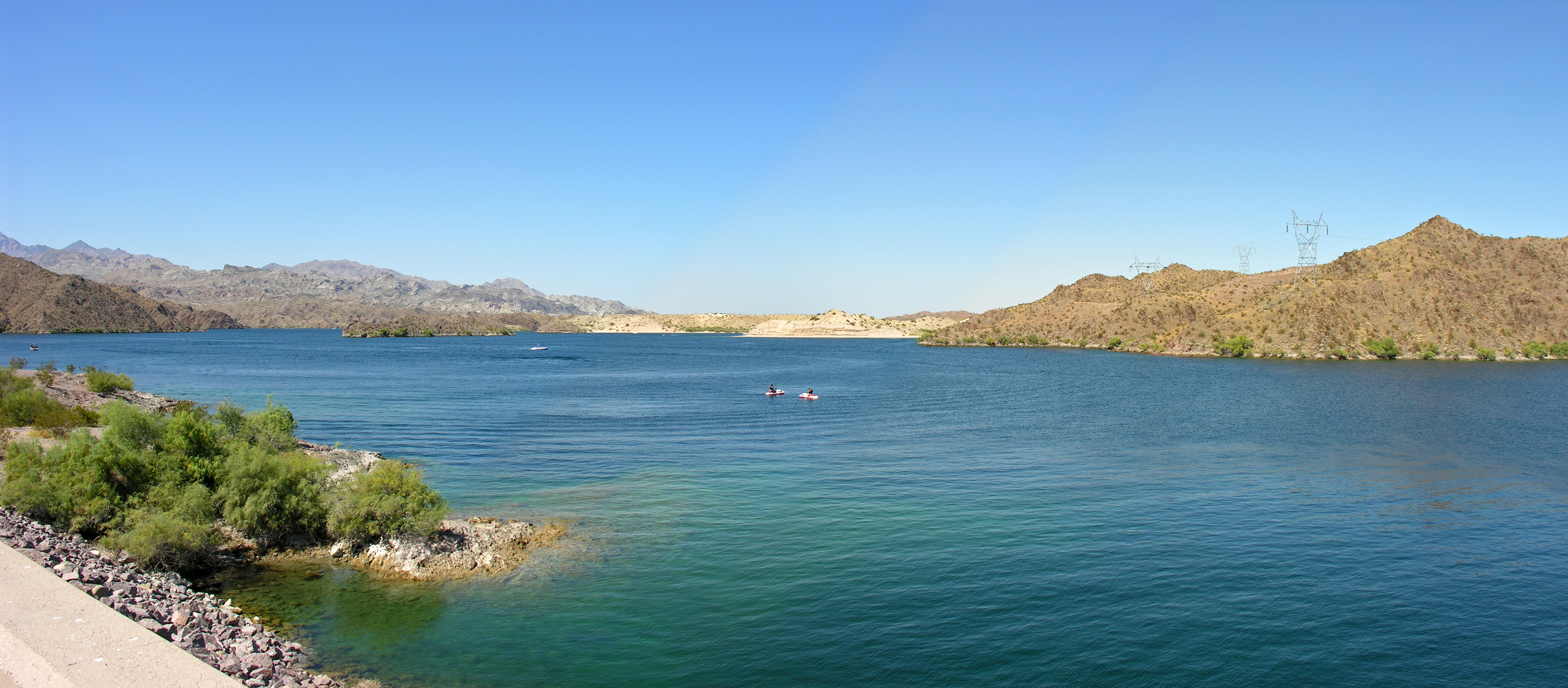
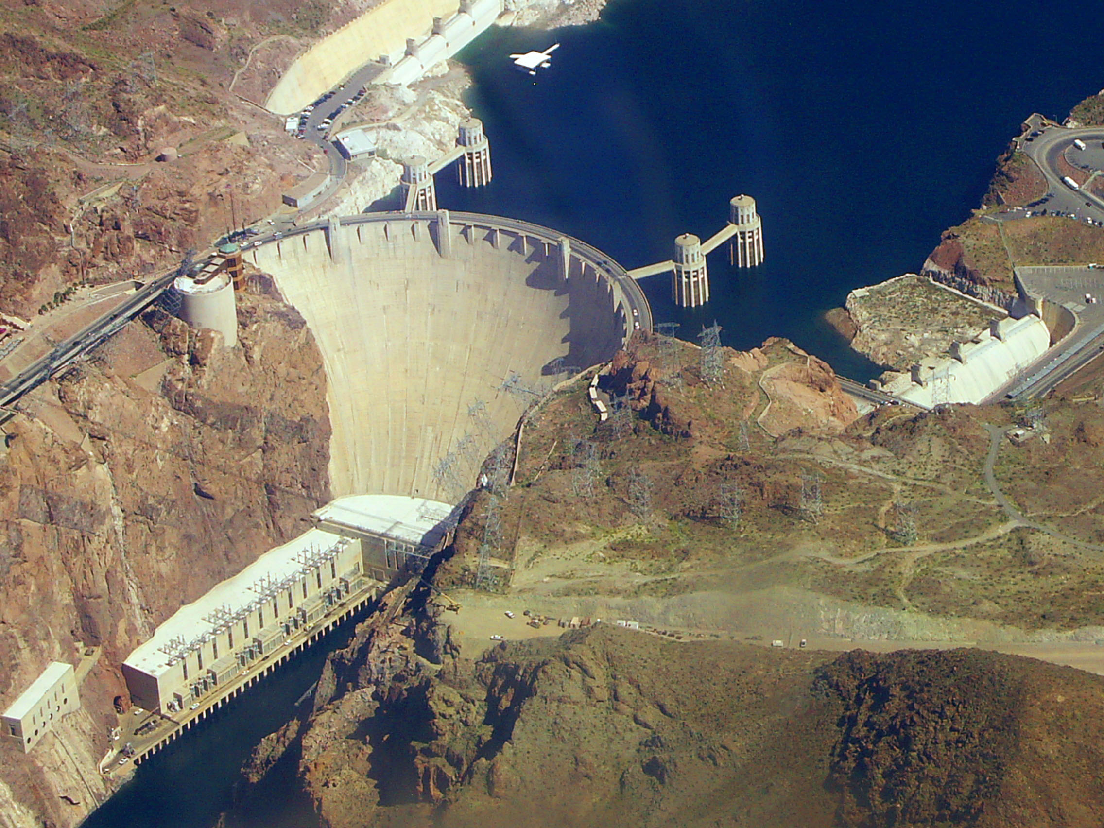
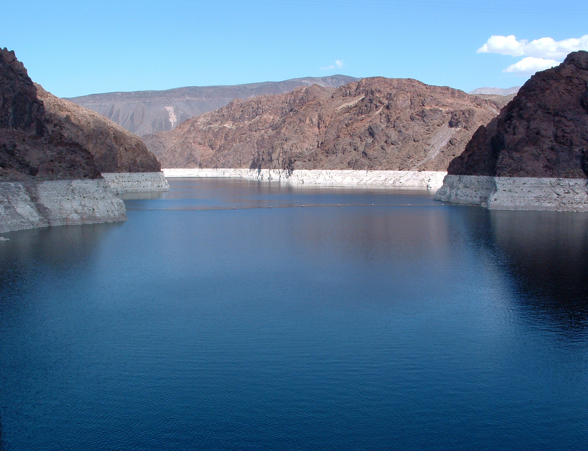
Below the Grand Canyon, the Colorado River flows past Lee Ferry, considered the legal division between the Upper and Lower Basins, and into Lake Mead, which is the major storage reservoir created by the Hoover Dam and adjacent to the rapidly expanding city of Las Vegas. Below Lake Mead, the River continues to form the border between Nevada and Arizona and California and Arizona. In this reach the flow is blocked by four additional major dams, including Davis Dam which forms Lake Mohave and Parker Dam which forms Lake Havasu. Although these reservoirs are much smaller in size compared to Lakes Powell and Mead, they allow water to be diverted from the River to be supplied to the Metropolitan Water District (MWD), which delivers water to the cities of Los Angeles and San Diego in California, and to the Central Arizona Project (CAP), which supplies water to numerous municipal and agricultural water users throughout Arizona, including the cities of Phoenix and Tucson. The additional dams include the Palo Verde Diversion Dam and Imperial Diversion Dam, which do not form significant reservoirs, but provide water to several large irrigation districts including the Palo Verde Irrigation District (PVID), Imperial Irrigation District (IID), and Coachella Irrigation District.
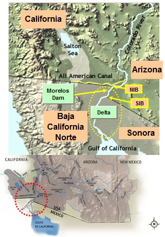
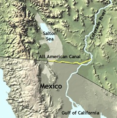
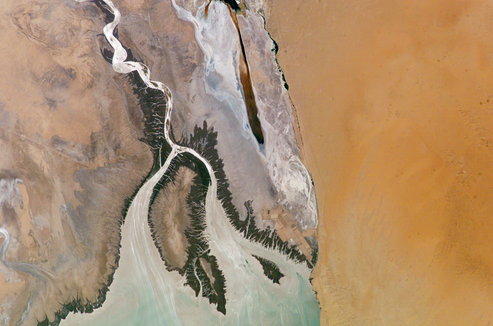
Below California at the Northern International Boundary (NIB), the River forms the international border between the United States and Mexico for approximately 24 miles (39 km) where the final structure, the Morelos Diversion Dam, diverts any remaining water for use in the Mexicali Valley and local municipalities. Finally, below the Southern International Boundary (SIB), the river channel is entirely in Mexico. After the 1450 mile (2330 km) journey from the Mountains of Colorado, the river empties into the Gulf of California, also known as the Sea of Cortez. The Historical Colorado River Delta extends from the Northern International Boundary to the Gulf.
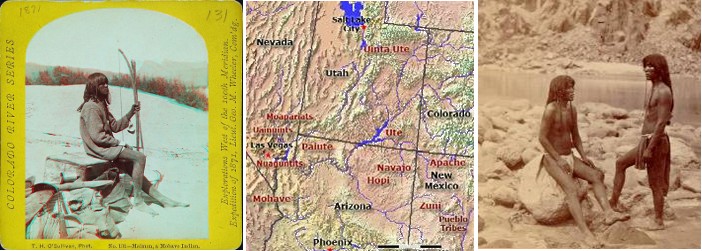
Native Americans have lived around the Colorado River and used its waters for thousands of years. These tribes built their cultures within the Basin long before Europeans arrived in the area. Elaborate canal systems and reservoirs indicate that many of these tribes had sophisticated water management practices to irrigate fields of crops, while other tribes relied extensively on the ecosystems the River provided for hunting grounds. Many of these tribes, such as the Mohave, Chemehuevi, Hopi, and Navajo, continue to use water from the river to farm and irrigate lands as well to pursue other economic opportunities.
American trappers and fur traders were the next group of Europeans to take interest in the Colorado. William H. Ashley organized the American fur trade in the Rocky Mountains and hired Jedidiah Smith, who discovered the beaver-rich Green River. Ashley himself descended the Green River—conducting the first navigation of the river—in 1825 in bullboats and provided the first authentic information regarding the upper Colorado, painting "Ashley, 1825" on a huge rock at Ashley Falls.
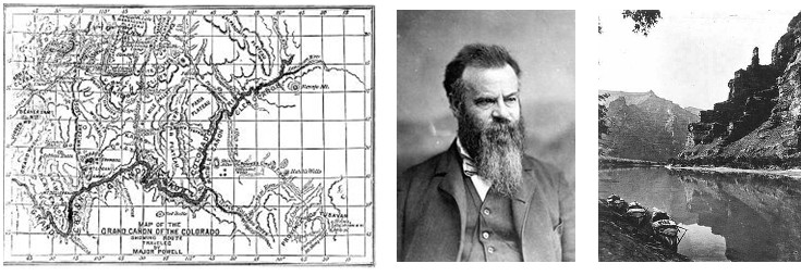
In 1869, an American named John Wesley Powell made the first thorough exploration of the Colorado River and the Green River. Powell’s crew navigated downstream from the Green River through the confluence with the Colorado River (at that time called the Grand River) and down the Grand Canyon. In 1871-1872, Powell retraced his route with another expedition producing photographs and an accurate map of his journeys.
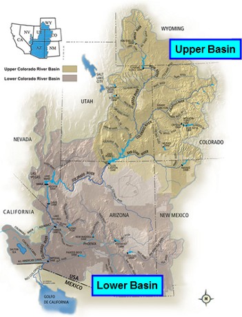
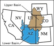
The cornerstone of the "Law of the River", this Compact was negotiated by the seven Colorado River Basin states and the federal government in 1922. It defined the relationship between the Upper Basin states, where most of the river's water supply originates, and the Lower Basin states, where most of the water demands were developing. At the time, the Upper Basin states were concerned that plans for Hoover Dam and other water development projects in the Lower Basin would, under the Western water law doctrine of prior appropriation, deprive them of their ability to use the river's flows in the future.
Using an estimate of 15 million acre-feet (maf) of water being available every year on average, the basin was divided into an upper and lower half, with each basin having the right to develop and use 7.5 maf of river water. This approach reserved water for future Upper Basin development and allowed planning and development in the Lower Basin to proceed. It is important to note that this estimate of 15 maf was based on the limited amount of data that was available at the time. In other words, this estimate was made with data collected over only a few years. Flows occurring prior to the existence of stream gages were simply unknown at the time. Recent research based on tree ring data has suggested that the long term annual average may be as little as 14.3 maf.
This act had four major components that paved the path for major water development on the Colorado River. These items included:
This agreement between the United States and Mexico committed 1.5 maf of the river's annual flow to Mexico.
Required the U.S. to take actions to reduce the salinity of water being delivered to Mexico at Morelos Dam.
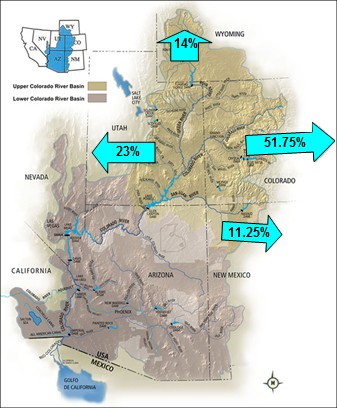
Created the Upper Colorado River Commission and apportioned the Upper Basin's 7.5 maf among Colorado (51.75%), New Mexico (11.25%), Utah (23%), and Wyoming (14%); the portion of Arizona that lies within the Upper Colorado Basin was also apportioned 50,000 acre-feet annually.
Established guidelines for defining surplus conditions based on reservoir levels and established allocations of surplus water to the Lower Basin States and Mexico depending on reservoir conditions.
Established guidelines for defining shortage conditions based on reservoir levels of Lakes Powell and Mead and governed the operation of the reservoirs in such conditions; also specified mandatory reductions in consumption for the Lower Basin states and Mexico.
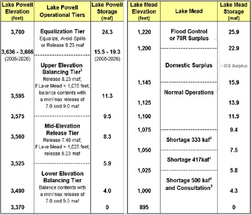
The table to the right shows how Lakes Powell and Mead are operated under various storage conditions of the reservoirs. Notice that on Lake Mead there can be “Surplus” conditions when the reservoir is high and “Shortage” conditions when the reservoirs are low. Complex operational rules are also established to determine the releases from Lake Powell based on the elevations of the two reservoirs. Often the contents of the two reservoirs are “balanced”.
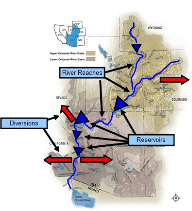
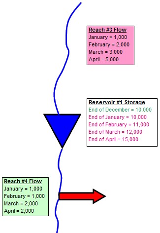
The Colorado River has many tributaries that supply water and many demands that extract water. The River is managed by the numerous laws, decrees and court rulings that are collectively referred to as the “Law of the River.” Understanding how all of these factors interact is a complex task, especially when supplies of water from rainfall and demands for water are constantly changing through time. To help us understand this complex system, water managers rely on computer models. These models are simplified representations of the real physical river and are built inside computer programs or spreadsheets. They often include the major components of a river basin such as river reaches, reservoirs, and lakes, and major water diversions such as cities or irrigation districts.
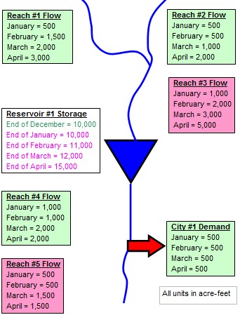
Data are collected such as how much water is available at different locations and how much water is demanded at different locations over a fixed period of time. Information is also entered that represents how much water is stored in reservoirs.
Look at the figure on the right. Each reach has some information representing the amount of water it has during each month. The reservoir has information that shows how much water it has at the end of each month.
Now convince yourself that if you have all the inputs (the information in green), then you can determine all the outputs (information in pink). That is what modeling is all about!
Modeling can get a lot more complicated. While we won’t discuss the numerous ways that models increase in complexity, here are a few points think about.